Storm Ashley: Amber warning as ‘weather bomb’ hits Scotland

- by Admin
- October 18, 2024

Ferries, flights and trains have been cancelled as Storm Ashley sweeps across the UK, with amber and yellow weather warnings in place throughout Sunday.
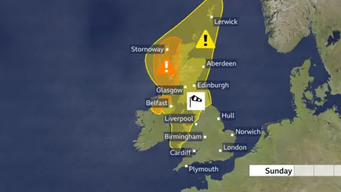
A yellow warning for high winds gusting up to 60 mph (97km/h) covers the whole of Scotland as well as Northern Ireland and some coastal parts of Wales until midnight.
High winds are expected to impact the north, east and much of south Scotland until 09:00 on Monday.
An amber high wind warning covers some western areas of Scotland, as well as the north and west of Northern Ireland, with gusts of 70-81 mph (113-130km/h) recorded.
The amber warning lasts until midnight in Scotland and and 20:00 in Northern Ireland.

The Met Office reported the strongest wind gust recorded was 81 mph (130 km/h) in Killowen, Northern Ireland, followed by 75 mph (120 km/h) in Capel Curig, Wales, and 70mph (113km/h) in Tiree in the Western Isles in Scotland.
Stronger gusts have been recorded at mountain sites, including winds reaching 102mph (164km/h) at Scotland’s Cairngorm weather station, which is 1237m (4058 ft) above sea level.
An amber weather warning means there is a potential risk to life and property.
A yellow warning means it is likely the weather will cause disruption.
The severe weather also brings a possibility of travel delays, road and rail closures.

Cancelled flights and ferries
Dozens of flights were cancelled at Belfast City Airport and Dublin Airport, mainly impacting Aer Lingus flights.
Belfast City Airport urged passengers to check the status of their flight with the airline before setting off to the airport.
Ferry operator CalMac cancelled almost all of its Sunday sailings on the west coast of Scotland, cutting off services to the islands including Arran, Bute, Lewis and Harris.
It has warned that more services could be cancelled at short notice on Monday. Passengers are urged to check the status of their ferry ahead of time.
Western Ferries, which operates the Dunoon-Gourock route, also suspended services on Sunday evening due to the worsening conditions.
P&O Ferries said its Sunday sailings between Larne in Northern Ireland and Cairnryan in Scotland’s south west were also cancelled.
In Argyll, the A83 Rest And Be Thankful was closed but the alternative route along the Old Military Road has been opened instead.
A warning was issued that if the wind speed increased any, the Tay Road Bridge would also have to close.
Road and rail closures
Some trains in Scotland have been cancelled, with many routes subject to speed restrictions.
Services between Barrhead and Kilmarnock have been cancelled, delayed or revised after a tree fell on the railway.
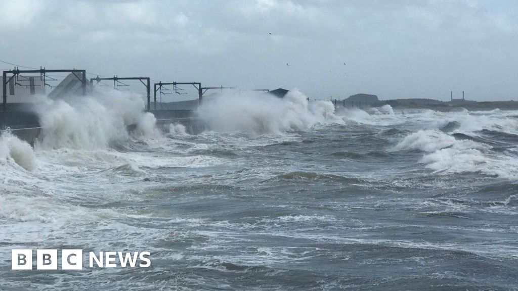
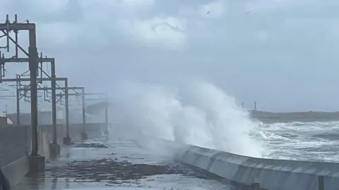
Network Rail have paused services between Kilwinning and Largs/Ardrossan due to waves coming over the sea wall at Saltcoats and reaching overhead lines. A replacement bus service has been put in place.
The northbound train line between Dundee and Aberdeen was temporarily closed due to flooding near Aberdeen, but has since reopened.
Train speed restrictions will be in place until Monday morning for services in the west and north Highlands, Ayrshire, Stranraer and between Perth and Inverness.
Train operator ScotRail issued advice to those travelling, urging them to check their services are still running.
The company warned that services on Monday morning could be affected by trees and debris on the track.
Transport Scotland spokesman Danny Chalmers told BBC News that people should be on “high alert”, and all areas could expect some travel disruption due to the weather warning.
He said that “people may be unused to driving to these very, very windy conditions.”
“When you get gusts of 80mph, there’s obviously going to be a significant impact on the ferries and speed restrictions on the rail travel and bridges. Police Scotland have been very clear that there is going to be an impact on transport.”

Flood warnings and power outages
Flood warnings – meaning flooding is expected – have also been issued by the UK’s environment agencies.
In Northern Ireland, thousands of homes were without power as a result of high winds.
Northern Ireland Electricity (NIE) Networks said its teams were working to repair damage and restore power.
Power had been restored in about 2,000 homes, but as of Sunday evening about 4,000 customers were still without electricity.
NIE Networks warned that the ongoing storm could see further power cuts, particularly in coastal areas, on Sunday night.
The Met Office had said there was a good chance of power cuts in the amber warning area which stretches from Argyll to Cape Wrath in the north, and covers many of the country’s island communities.
Some events have been cancelled due to the storm, including the Enchanted Forest light show in Pitlochry on Sunday night.
In England, Sunday’s Great South Run was cancelled. The 10-mile race in Portsmouth was pulled after organisers said they could not safely deliver the event due to the weather.
Meteorologists say Storm Ashley, the first named storm of the season, saw a rapid drop of pressure as it moved in from the Atlantic on Saturday night – a phenomenon called a “weather bomb”.
The phrase is taken from the US term “bombogenesis”, used to described a fall of at least 24 millibars of pressure in 24 hours.

Storm Ashley packs a punch
Storm Ashley will pack quite a punch in terms of wind strength.
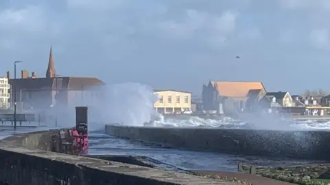
The timing of this storm will also heighten its impact. The current high tides because of the full moon will increase the risk of coastal flooding and disruption.
This early in the season, lots of trees are still in full leaf which makes them more likely to be damaged or even downed in the strong winds.
And in many cases garden furniture and toys are still out – so make sure anything that could be blown away is secured.
The strongest winds are likely to be on Sunday, lasting through the evening period and the first part of the night.
It’ll still be very windy on Monday, especially in the north, but the winds will slowly moderate as the day goes on. Tuesday and Wednesday look like quieter days.
The Latest News
-
December 23, 2024On board with the pilots doing one of Britain’s toughest jobs
-
December 23, 2024Donald Trump taps ‘Apprentice’ producer as special envoy to UK
-
December 23, 2024Daily horoscope: December 23, 2024 astrological predictions for your star sign
-
December 23, 2024Sharp fall in UK business activity forecast as economic gloom deepens
-
December 22, 2024Foxtel offloaded to UK streamer for $3.5b


